


The Ocean Consensus
Community-led Marine Protection in Zanzibar’s Pemba Island
Over four months in late 2024 and early 2025, 4,000 fishers, farmers, and community leaders voted, village by village, to restrict their own waters.
The waters they voted to protect hold something irreplaceable: seventy square kilometres of climate-resilient coral reef that has survived temperature swings devastating reefs elsewhere and one of the last living reservoirs in the Western Indian Ocean from which recovery can ripple. If these reefs fail, there may be no reservoir from which to rebuild.
The communities along Pemba's eastern coast chose protection not because it was required of them, but because they helped design what it would mean and wanted their children to inherit more than empty waters.
Pemba Channel
The deep waters of Pemba Channel, located between the Tanzania coast and Pemba Island, keep temperatures more cool and stable than the surrounding ocean.


Communities Shaping the Future
The meeting hall in Micheweni fills before dawn. Fishers arrive first, salt-stiffened nets still drying on their shoulders. Then come the Shehia leaders, women's cooperatives, youth representatives, elders whose memories stretch back before independence. By sunrise, the room is full of voices that have known the waters surrounding Pemba Island for generations.
They know where the coral runs shallow enough to scrape a wooden hull, where the reef drops into blue depth, when currents shift and which winds foretell dangerous seas — knowledge carried across boats and down through generations long before anyone drew a boundary on a map.


Officials from the Revolutionary Government of Zanzibar stand at the front. Their question will determine the future of 1,300 square kilometres of ocean: Should these waters become Protected Areas? That answer will be decided in this room and forty-two others across the coast.
On June 10, 2025, those village-hall votes arrived on a global stage. At the UN Ocean Conference in Nice, the Revolutionary Government of Zanzibar announced the designation of two new marine protected areas: the North-East Pemba Conservation Area (837 km²) and the South-East Pemba Conservation Area (468 km²). The 4,000 people who voted had made a decision that would now be heard by the world.
The pressures that
pushed
Pemba to a decision
Hadija Rajab Ali has fished these waters since childhood, reading the sea the way others read the sky — where grouper gather before spawning, where currents break on the reef edge, when sharks hunt in shallow water.
the sea she fishes today.
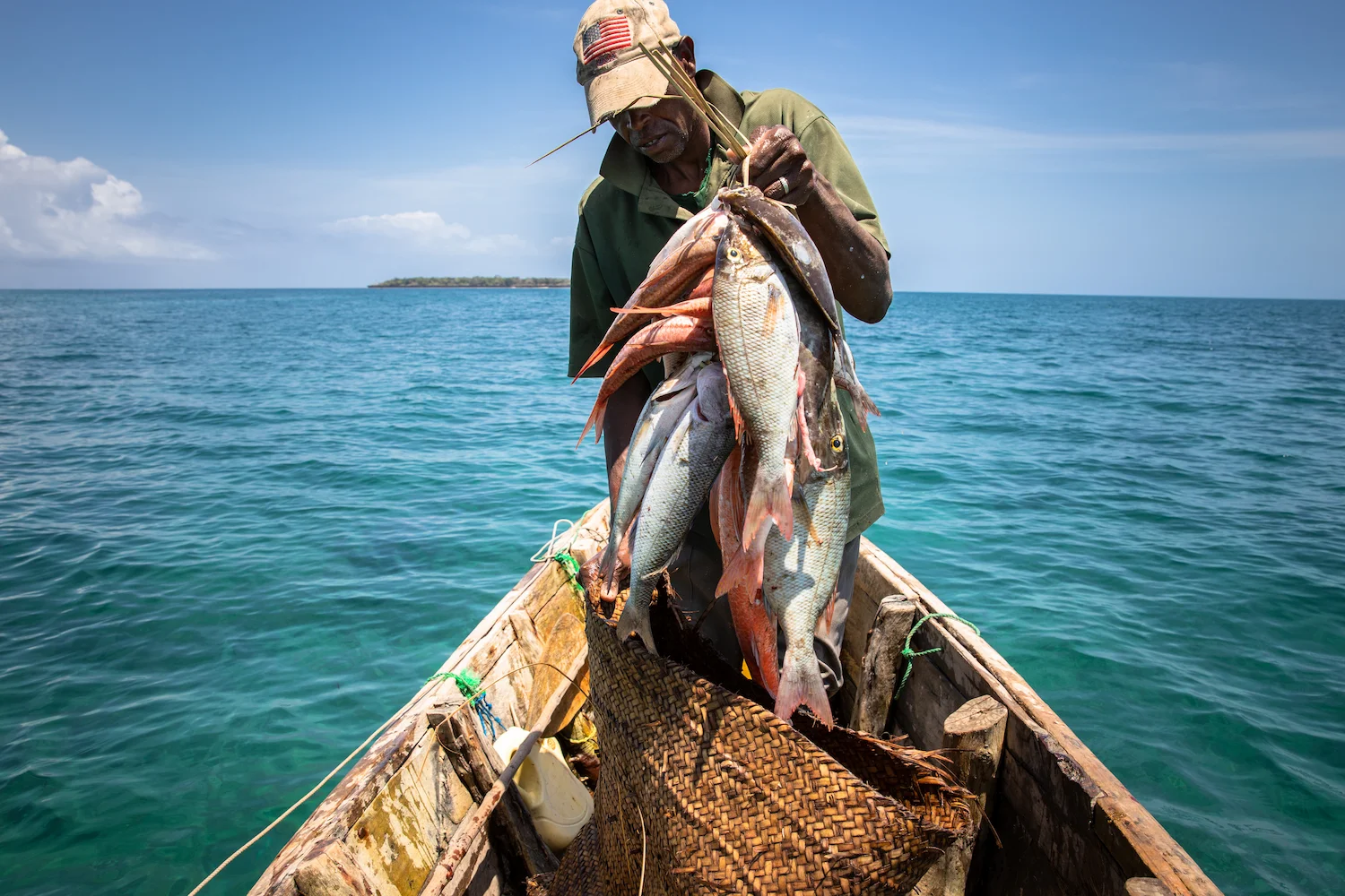
Ninety percent of Zanzibar's fisheries are artisanal — small boats, hand lines, families who eat what they catch and sell the rest — and all of them reef-dependent. Pemba's population has nearly doubled in two decades. As catches declined, fishers went farther, stayed longer, and used finer-mesh nets that trap juveniles before they can reproduce. Coral gardens that once recovered between seasons now bear scars that spread faster than they heal.
Pemba East had remained peripheral while other parts of Zanzibar benefited from tourism investment and conservation funding. The communities living beside globally important biodiversity saw little of its benefit. Climate change pressed on every wound — warmer waters pushing species away, acidification weakening coral skeletons, storms growing stronger against a mangrove buffer already thinned by coastal development.
Hadija watched it happen. So did the elders whose memories stretched back generations. The question was stark: would protection restore what was being lost or just make it harder to thrive?
A Coastline the World Depends On
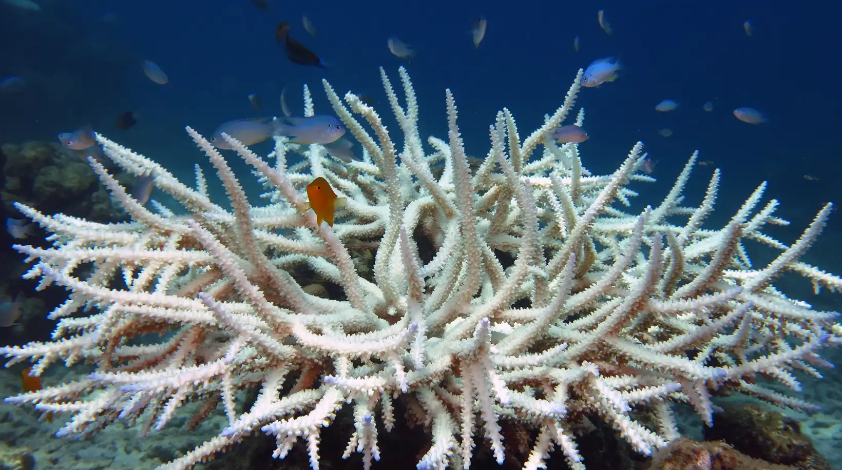
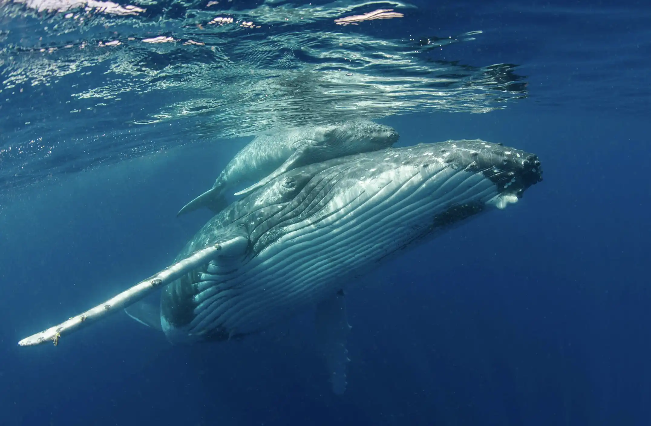
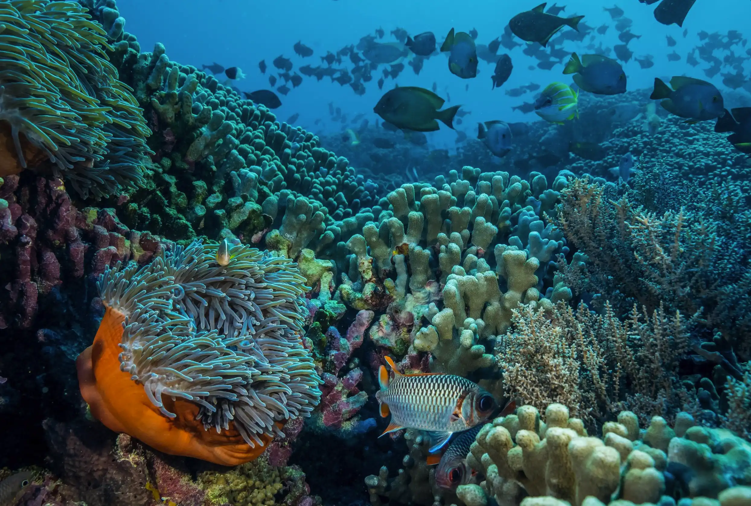
Divers who descend on Pemba's eastern reefs describe a cathedral effect — coral towers rising fifteen metres from the seabed, light filtering through gaps in the structure, fish moving in clouds so dense they momentarily block the sun. These are among the most biodiverse reef systems in the Western Indian Ocean, shaped over millennia into structures no restoration programme could recreate.
Seventy square kilometres of climate-resilient coral reefs form living fortresses that have survived temperature swings devastating reefs elsewhere. Scientists call them 'refugia' — cooler, geographically sheltered waters where genetic diversity persists even as climate change strips it away across other regions.
70 km² of climate-resilient reef that may be the last reservoir for rebuilding
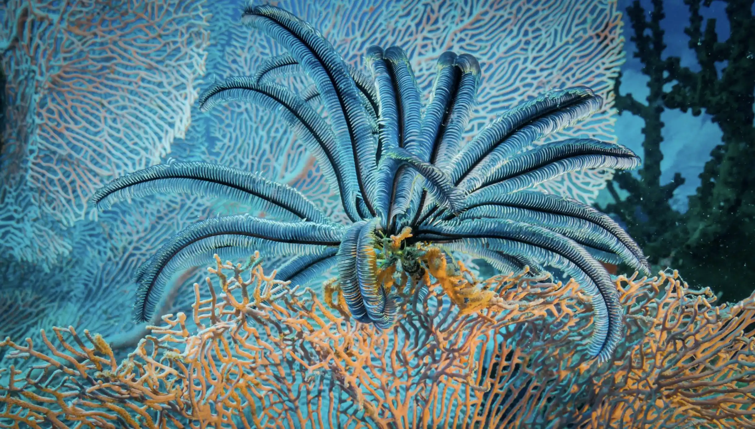
Between these coral structures stretch twenty-six square kilometres of seagrass. The meadows sway quietly beneath the waves, invisible from shore, but they perform work essential to life along this coast: storing carbon faster than terrestrial forests, filtering water, and providing nursery habitat for the fish species that underpin the local economy. Among their blades, tiny invertebrates shelter alongside threatened dugongs — creatures now absent from much of their historical range.


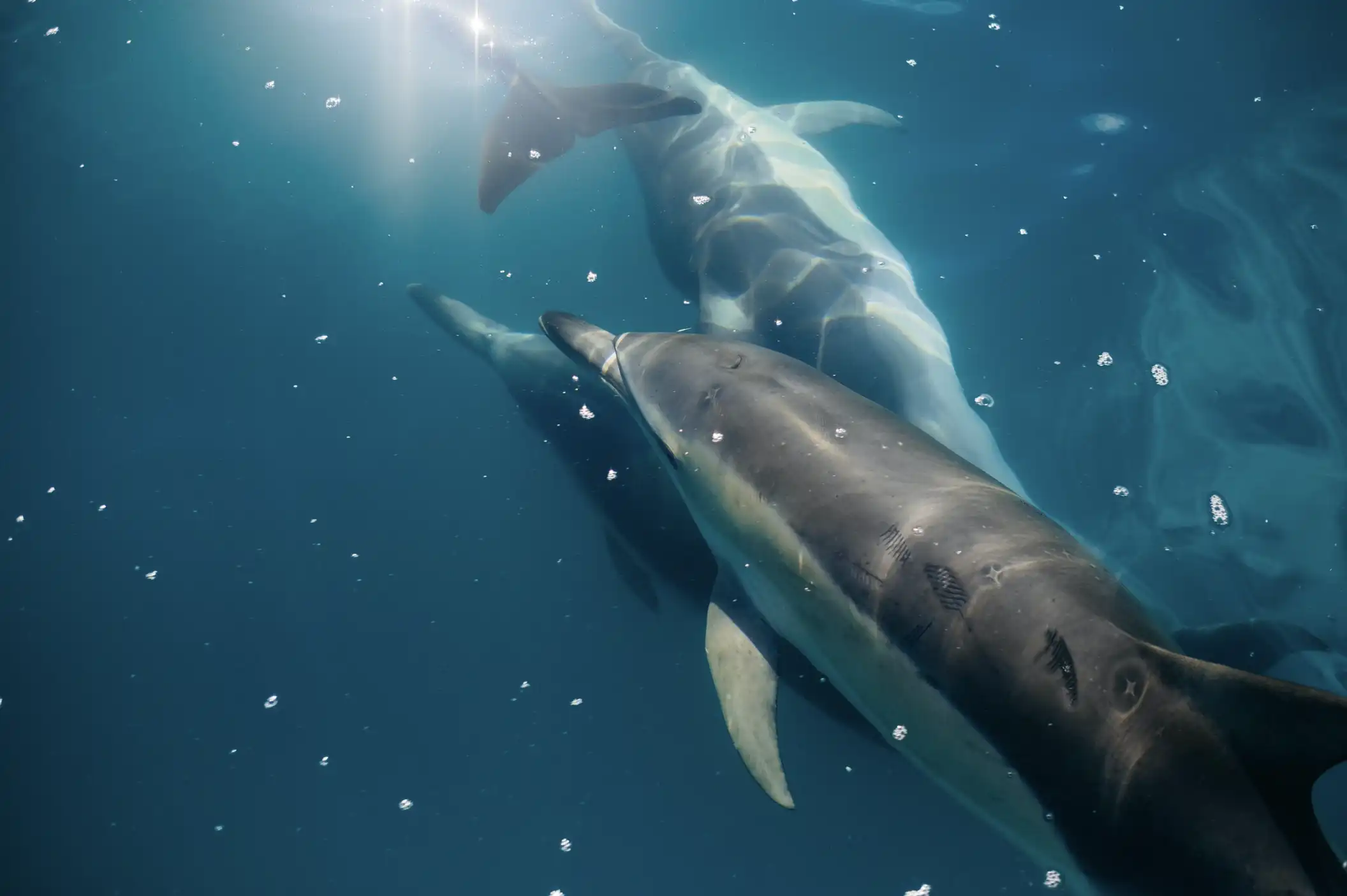
Guarding the coastline, mangroves weave a barrier between land and sea — roots slowing storm surges, trapping sediments before they smother the reef, nursery to countless species. As storms intensify, these forests may be the deciding factor between villages that endure and villages that wash away.Moving through this whole, interconnected system are sharks and rays representing more than half of the Southwest Indian Ocean's threatened elasmobranch species. Their presence signals system-wide health: apex predators can only persist where the food web beneath them remains intact.
.webp)
But health is not immunity. The pressures closing in — population growth, destructive fishing, warming seas — were beginning to exceed even this system's resilience. If these reefs fail, there may be no reservoir from which to rebuild.
Forty-three villages, one question
Between December 2024 and March 2025, government officials and WCS teams moved from village to village along the eastern coast with a single question: Should these waters become protected?
The process was slow, and intentionally so. More than 4,000 people participated. Fishers raised concerns about where no-take zones should lie. Women dependent on seaweed cultivation shaped plans to ensure cultivation areas remained accessible. Youth representatives pressed for opportunities in monitoring, tourism, and restoration. Village leaders spoke about the responsibility to protect resources that future generations will depend on.
But the real story was the work that preceded it — a democratic process that made communities partners in the stewardship of the ocean.

What Protection Now Means
The new protected areas are not sanctuaries sealed from the people who depend on them. They are places where recovery and use are designed to reinforce one another.
Some stretches of reef will be left untouched — no fishing, no anchoring — so corals can rebuild and fish populations rebound. Others will remain open to artisanal fishing, guided by methods that have sustained these communities for generations. Along parts of the coast, villages will manage their own marine areas, drawing on customary knowledge to determine what takes place and when.
.webp)


In places where reefs have been scarred or mangroves thinned, recovery work will begin — coral fragments grown in nurseries and replanted on damaged reefs, young mangroves set into mud flats where storms have carved new channels. And in waters where the reef walls drop into deep blue, communities are planning how tourism might bring revenue without overwhelming the very ecosystems visitors come to experience.
Enforcement will depend on fishers like Hadija, who know these waters intimately and have reason to defend the rules they helped create. When catches improve, they become the first line of protection. When tourism revenue begins to flow, the health of the reef becomes economic self-interest.
Moving through this whole, interconnected system are sharks and rays representing more than half of the Southwest Indian Ocean’s threatened elasmobranch species. Their presence signals system-wide health: apex predators can only persist where the food web beneath them remains intact.
But health is not immunity. The pressures closing in on Pemba’s coasts — population growth, destructive fishing, warming seas, coastal development — were beginning to exceed even the resilience of this extraordinary system.
A pattern larger than Pemba
Marine protected areas are being designated at unprecedented speed as nations work toward 30×30—the global commitment to protect thirty percent of ocean territory by 2030. But governments are discovering that designation alone doesn't guarantee outcomes. The MPAs that succeed tend to share a common feature: communities who see themselves as partners, not bystanders.
.webp)
Zanzibar's approach in Pemba—investing months in village-by-village consultation, designing zoning collaboratively, ensuring communities could shape the outcome—represents a commitment that many countries are now watching. If this model proves durable, it offers a pathway others can adapt: protection that holds because it was built on consent.
The work ahead —
and the model emerging
Designation is only the beginning.
Governance structures must earn legitimacy through use — decisions debated, conflicts resolved, boundaries respected when the pressures of daily life make that difficult. Livelihoods will evolve as fishers adapt to new zones and communities build alternative sources of income. And all the while, climate change will keep testing the very qualities that have allowed these reefs to endure.
Pemba has shown something rare: a pathway built on legitimacy rather than imposition, shaped by communities who understand these waters, supported by science, and aligned with national ambitions for climate resilience and development.
Where the coral grows
Standing again in Micheweni’s meeting hall, you see beginnings rather than conclusions. Children dart between clusters of adults discussing zoning maps. Fishers debate where currents may shift as reefs recover. Women confer about how to ensure seaweed farms remain protected from storms. Elders speak of how the coastline has changed, and how it might change again.
That consensus anchors the new MPAs, and it will determine whether the reefs, mangroves and seagrass meadows they chose to protect will endure. Its significance extends far beyond Zanzibar. Across the Western Indian Ocean, countries are searching for ways to meet 30×30 commitments without sacrificing food security or local economies.

.webp)